Thursday, June 10, 2010

Day 3 - Spring 2010 Trip to Mackinaw City, MI


The final day of my trip to Mackinaw City and Michigan's Upper Peninsula, like the 1st two, started with interludes of rain/drizzle as I left Rhinelander, WI. Heading southwest, I approached Tomahawk, WI. Having never traveled thru there, it was my 1st "exploration" of the day. Tomahawk is located on Lake Mohawksin along the Wisconsin River, and is home to a huge Packaging Corporation of America plant....


Piles and piles of logs surrounding the facility. At 7am, not much was moving in downtown Tomahawk, so I continued on, heading out of town. I soon realized that the road I was on was NOT heading south, as desired. So I had to get a bit more serious about getting back to Hiway 51.... Soon I came upon the Wisconsin River again, and several neat river cabins/homes, which looked like great getaway places... There were references to the "GrandFather" and "GrandMother" Flowages, but not really sure what those were relating to. This portion of the Wisconsin River was narrow and "lively".... according to a fishing article this is a great fishing environment. It also looks like a great canoeing river.


Following country roads further east, I finally ran into the main Wisconsin North/South Hiway 51 (often referred to as "the Route 66" of Wisconsin). I settled in with coffee and sports talk radio and set sights on the Wisconsin Dells. As I approached the Dells, the rain started to fall again, and it was at that point I opted for my "rain deterrent" plan - a casino......

Located just south of The Dells on Hiway 12, the Ho Chunk Casino is a stopping point Sue and I came across a few years back.


Knowing I was up $20, I figured I had "house money" to gamble with. Sure enough, I hit it "big" on the penny slots, and found myself up $75 for the day! Being the wise person I am (NOT), I kept playing.. well, to make a long story short, I left the casino up only $30. This is a 1st... two casino visits, and AHEAD $50.... in the 20 years of visiting casinos, I have never left ahead!

With that, I decided to head back out, and as with the 1st casino visit, the rain had stopped. Though the sun had not broken out yet, it was working on it. At this point in the trip, the reality of the mini-vacation coming to an end was setting in, and thoughts of all the things I had waiting for me to do back at home began filling my mind. So I set the cruise control and headed SW down 2 lane hiways thru the picturesque Southern Wisconsin countryside. Hiway 60 follows along the banks of the Wisconsin River, and compared to my previous encounters with the River earlier in the day, this portion was wide, and shallow, and very placid.... much, much different than upstream in North Central Wisconsin.


Soon the bluffs around Prairie du Chien appeared. Time for one final gas stop before the last leg back to Waterloo via Strawberry Point. I arrived back in Waterloo approximately 3pm. The trip was a little over 1500 miles, and with the on and off rain, this three day journey was one of the more taxing trips I have taken. But I was able to see some beautiful countryside, and interesting sights, and get some good ideas for a future trip to the Mackinaw area with Sue!

Wednesday, June 9, 2010

Day 2 - Spring 2010 Trip to Mackinaw City, MI


Day 2 of the Mackinaw City, and the Michigan Upper Peninsula began bright an early on Saturday morning. The rain had stopped, and there were actual signs that the sun may even break out.

I checked out of the Baymont Inn and Suites about 6am, and decided to first check out the downtown and lakeshore areas of Mackinaw City. As mentioned in the Day 1 summary, the downtown area is filled with plenty of specialty and boutique type stores.

Passing thru the downtown, you come upon Shepler's Ferrys, a shuttle service to/from Mackinac Island. There are numerous ferry services that leave from Mackinaw City, and all are on the eastern lakeshore area.


The shoreline also is filled with hotels and condos which face Lake Huron, and the waters to Mackinac Island.


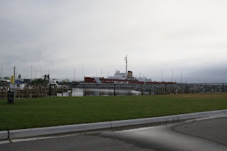
There is also a HUGE parking lot along the boat ramp, for those who want to set sail on their own. Moored next to this boat launch area is a Coast Guard Icebreaker... I couldn't get very close, but it looks like a huge ship! I should note that all this time there were "thousands" of mosquito/gnat type bugs in the air along the shoreline.... even some of the photos I took, blurred the images with the dots of the bugs in the air... I didn't stay long ... the bugs won this battle!


Ok, its time to explore the historical area of Mackinaw City. The lakeshore area facing the Mackinac Bridge has been converted into a parks and walking trail that includes the Old Mackinaw Point Lighthouse and Fog Signal Station, Alexander Henry Park, Fort Michilimackinac Welcome Center, and numerous areas to picnic or just sit and enjoy the view.

(Click on image for PDF version)

This area also provides access to the south end of the Mackinac Bridge. Here's a couple photos of the bridge from the shoreline...


The Old Mackinaw Point Lighthouse is the main focal point of the park area. Since it was before 9am, access to the lighthouse was not possible.


Time to head north.... The drive back across the Mackinac Bridge Saturday morning, although overcast and a bit foggy, provided a fabulous panorama of the Mackinac Straits. The following video shows the six minute trip across the bridge.....


On the North Shore of the Mackinac Straits is the town of St. Ignace. This town also serves as a launching point for travel to Mackinac Island, with multiple ferry services offering transportation, with hotels and shops near the ferry launches. Here's a photo of the St. Ignace harbor...


From St. Ignace I traveled the South shoreline of the Upper Peninsula East to the small fishing town of De Tour Village. There are several small bays and coves along the route. The following photos show a view of Bush Bay, and the view along the coastline.


De Tour Village is located on the Eastern end of the Upper Peninsula. This small town provides ferry service to Drummond Island, as well as boat launching facilities for boating and fishing enthusiasts. It is also at the confluence of one of the passageways from Lake Superior to Lake Huron.

From De Tour Village, I headed North to Sault Ste. Marie, MI via the back roads. Some very serene and picturesque countryside. I should note that cell phone usage in this area must not be a priority, as cell reception was scarce at best. But looking at the lifestyles in this area, I could see that instant communication with others is not a high priority! Below is a shot from the hiway as I approached a small village along Raber Bay.


The next stop was Sault Ste. Marie, Mi. Located on the St. Mary's River passageway between Lake Superior and Lake Huron, and bordering Canada, this city is home to the Soo Locks. All ship travel between these Great Lakes has to pass thru the Soo Locks. Its interesting to note that the original locks in this area were located on the Canadian side of the river. However, due to the increasing ship size, the United States constructed the current Poe and MacArthur Locks, and those now are the main passageway. The shoreline around the locks have been converted into a park maintained by the Army Corps of Engineers, and has "dockside" viewing of the ships passing thru. Due to the rain, I opted not to enter the park, but was able to view a ore freighter and a personal sail boat passing thru from the main road along the locks.


Sault Ste. Marie also has other sight seeing locations which include the Museum Ship Valley Camp and the Tower of History. Here's some shots of both those locations.

With the rain beginning to fall again, it was time for a break, so with my GPS, I looked for casinos in the area and set sites for the Bay Mills Resort and Casino. Located on the shores of Waiska Bay, the resort was hosting a "fishing swap meet" - WOO HOO!! I reluctantly passed on viewing the merchandise in the parking lot tents, and went directly to the slot machines inside..... It was a good decision to wait out the rain in a casino... I left AHEAD $20, and when I walked out, the sun was shining!


Just a short distance up the road was the Iroquois Lighthouse. With the sun shining, I saw a perfect "photo op", and began exploring the grounds. I visited with a man working on the landscaping, who indicated that he and his wife and daughter were caretakers at the lighthouse, and lived on the grounds. He invited me to climb the lighthouse tower to get some photos of the head of the St, Mary's River and the surrounding countryside. This lighthouse served as a guide to ships heading to the Soo Locks. The photos don't capture the setting I was experiencing. The blue skies and water, the perfectly calm (and fresh air) and the breathtaking views... I'm glad I decided to check out this area of the Upper Peninsula!


The final stop of the day before heading to Rhinelander, WI for the night was Marquette, MI. The rain was setting back in so I briefly stopped at their harbor area... One of my favorite sites to visit are the old "ore docks" used to transfer ore from trains to ore ships. Marquette Harbor also has an abandoned dock, which is a main feature of the surroundings.


The downtown area facing the harbor has been reconstructed to integrate into the harbor and park area. A row of new condominiums has been built to provide residents amazing views of Lake Superior and the Marquette Harbor park.

The rain was back bigtime, so after a stop for coffee, and gas, I turned Southwest for Rhinelander, WI. Arriving in the rain about 6:15pm, I was ready to crash. So after checking in at the Americinn - Rhinelander, and then running across the parking lot to grab a "nutritious" Culver's double butter burger with jalapenos for "room service", Day 2 was officially "in the books."


Day 3 to follow....


Tuesday, June 8, 2010

Day 1 - Spring 2010 Trip to Mackinaw City, MI


Day 1 started early, leaving Waterloo with my coffee and donuts approximately 5:45am. This time of year, the sun is up early, so with Bob and Tom cranked up on the radio, I headed east to Dubuque (with a quick stop for coffee), then to Madison, Wi, making great time.

After another coffer stop (nothin beats cruisin' along with a good cup of coffee!) in Madison, and anticipation building as I moved closer to the great North Woods, the rains began..... I knew it was coming, but didn't think I'd hit it so soon, and it would last so long! So there were not many "photo ops" on the Day 1 drive.

Time for the 1st gas stop, and unfortunately, for a die-hard Bears Fan, it was in Green Bay, WI. Since I was so close to Lambeau Field, I thought this was a good time to test out the new feature on my trip - "The Dash Cam". I only post this for my "Packer Friends" (maybe I should say acquaintances, as I cannot admit to being friends with Packer Fans). I must say, it is definitely a landmark of the town, and couldn't pass up the chance to capture at least a little bit of the field. (I apologize in advance for the rain filled windshield, and the wipers pounding away.. but hey, at least some video!)


The 2nd test of the "dash cam" came in Escanaba, MI, where I revisited their shoreline park along Little Bay de Noc (North end of Green Bay)... Its a neat area, and for you maritime buffs, there's a small museum, along with an old lighthouse to explore.

From Escanaba, with rain pounding, I hit the main road along the northern shores of Lake Michigan, on my way to Manistique, MI and ultimately, the Mackinac Bridge. There were two lighthouses near Manistique, but with the rain, and the fact they both were on gravel/dirt (now mud) roads, I opted not to stop this time, and replaced their stops with one to grab some refreshments.

The drive along the North Coast of Lake Michigan in the Upper Peninsula was nice.. not alot of traffic, several small bays overlooking Lake Michigan, and massive expanses of woodland... my kind of country! But with the rain, it lost some of the luster to explore. By now I was approaching 10 hours on the road, so I was anxious to get to my primo sight of the trip, the Mackinac Bridge! I took "Dash Cam" footage crossing southbound, but with the rain and wipers, I will save the video footage until I post Day 2 information, and the video crossing Northbound to St. Ignace. I must say, it was a bit nerve wracking crossing alone, with this HUGE drop to the water, "see thru" bridge decking in the center lanes, and rain pounding the entire time, but boy, what a view! Even with the rain!

The Mackinac Bridge dumped me right into downtown Mackinaw City. Being after 6pm, and raining, not many people were out and about. There were tons of motorcycles parked in the town, and even cruising around in the rain... (I suspect the Upper Peninsula, and the Mackinaw City area are big motorcycle touring areas). The main downtown strip was filled with many small specialty shops, and as you approached the shoreline, you found the Ferry launches, alot of hotels, and many more food and shopping establishments. Looks like a great place to spend the day wandering the stores, enjoying a few "beverages" and food, and checking out the lakeshore views.

Here's the video of my "drive thru" in the rain on friday nite.


Time to call it a day, so I headed to my hotel - Baymont Inn & Suites. A REALLY nice hotel, esp. the price. It wasn't on the shoreline, so that probably helped keep the cost down. The interior and rooms had been recently refurbished, so it was a perfect spot to crash for the nite.

A long, but interesting day.... Stay tuned for Day 2.